A practical guide to trail access, food stops, road crossings and planning your walk or ride.
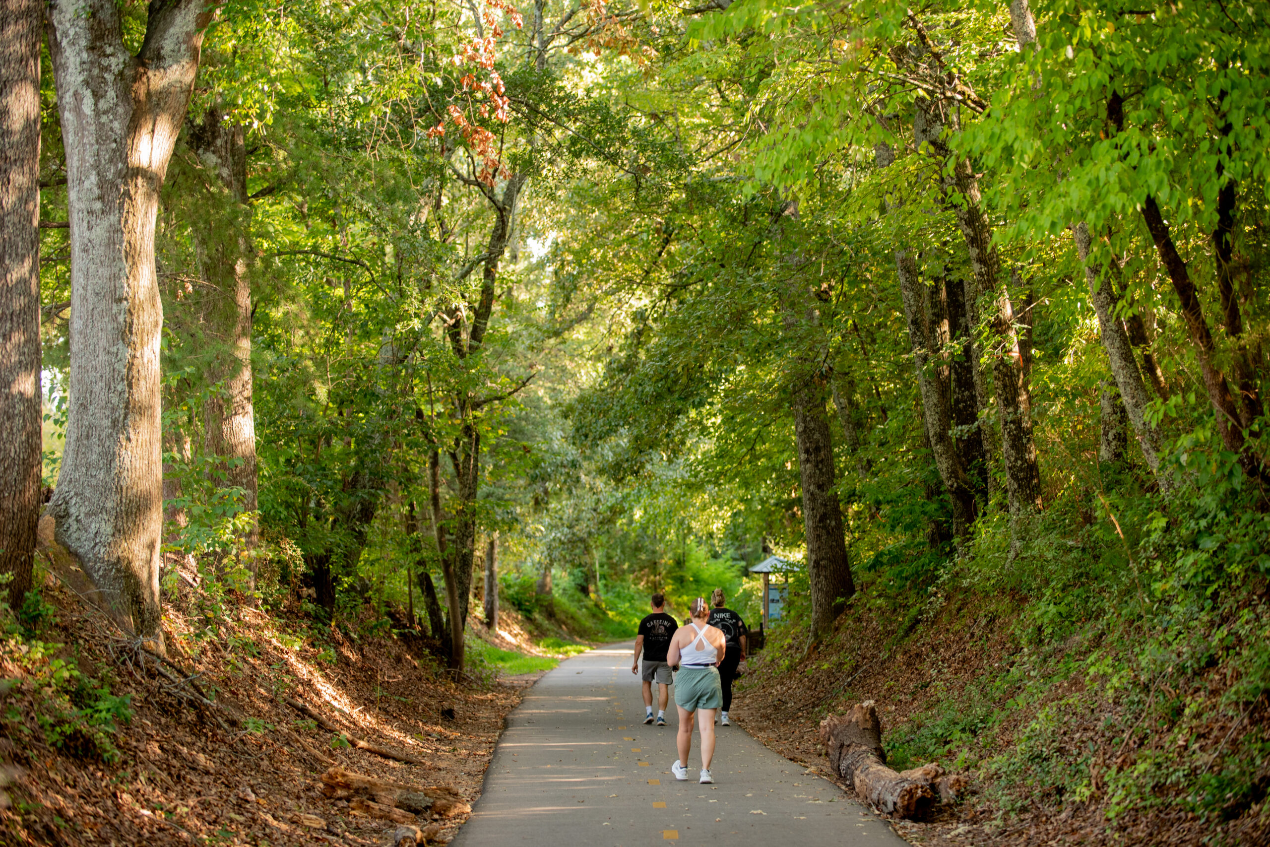
The Prisma Health Swamp Rabbit Trail runs through downtown Travelers Rest, South Carolina, connecting Main Street with Furman University and Greenville farther south. You can use it for a short walk before breakfast, an afternoon bike ride or a longer outing with stops along the way.
This guide focuses on starting in Travelers Rest: where to park, where to rent a bike, what to expect at crossings and where to stop for food.
Parking for the Swamp Rabbit Trail
Two starting points are Gateway Park and Trailblazer Park, both identified as parking options by South Carolina’s official trails resource.
Gateway Park
115 Henderson Drive, Travelers Rest
Gateway Park is behind Sunrift Adventures, near the downtown Main Street and Center Street area. It is a useful starting point when your outing includes downtown businesses.
Trailblazer Park
235 Trailblazer Drive, Travelers Rest
Trailblazer Park is another option for starting near town. Markets and other events can affect how busy the parking area is.
Before leaving, open the official Greenville County Swamp Rabbit Trail map. It identifies parking, public entrances, restrooms and road crossings. Use it to follow the connection from your parking spot to the main trail, and observe posted parking restrictions.
Bike Rentals in Travelers Rest

Freehub Bicycles offers bike rentals at its Travelers Rest location:
110 South Main Street
864-823-9723
Visit Freehub’s bike rental page to review options and arrange your rental.
Ask about bike sizes, helmets, rental duration and return times. If you are bringing children, confirm suitable equipment before booking.
Sunrift Adventures also has a bike shop and rental information available through its website. Confirm current bike availability and arrangements directly.
Choosing Your Direction
From downtown Travelers Rest, heading south takes you toward Furman University and Greenville. Heading north takes you toward the northern end of the trail corridor.
Choose the outing before choosing the distance:
| Your plan | How to approach it |
|---|---|
| A short walk | Start downtown and choose an out-and-back route |
| A first bike ride | Pick a turnaround point using the official map |
| A ride toward Furman | Follow the southbound route and identify campus connections |
| A longer food-stop ride | Map the destination and account for the full return trip |
Greenville County describes the trail system as a 32-mile-and-growing network. That number represents the wider system, rather than the distance from Travelers Rest to downtown Greenville.
Out and Back at Your Own Pace
No. An out-and-back outing lets you choose your distance without arranging transportation at the other end.
For a first visit, start near downtown, walk or ride for fifteen to twenty minutes and return for coffee or lunch. For a longer ride, choose a destination and check the round-trip mileage before setting out.
Allow time for crossings, breaks and your rental return deadline. The ride back is part of the plan.
Coffee and Food Stops Along the Trail
Stops in Travelers Rest
Tandem Creperie and Coffeehouse offers coffee and sweet or savory crêpes near the Main Street and Center Street intersection.
TRee House Café & Studio combines coffee and food with a purchase-and-paint experience if you want a longer indoor stop.
Sidewall Pizza Company serves pizza, salads and ice cream along South Main Street.
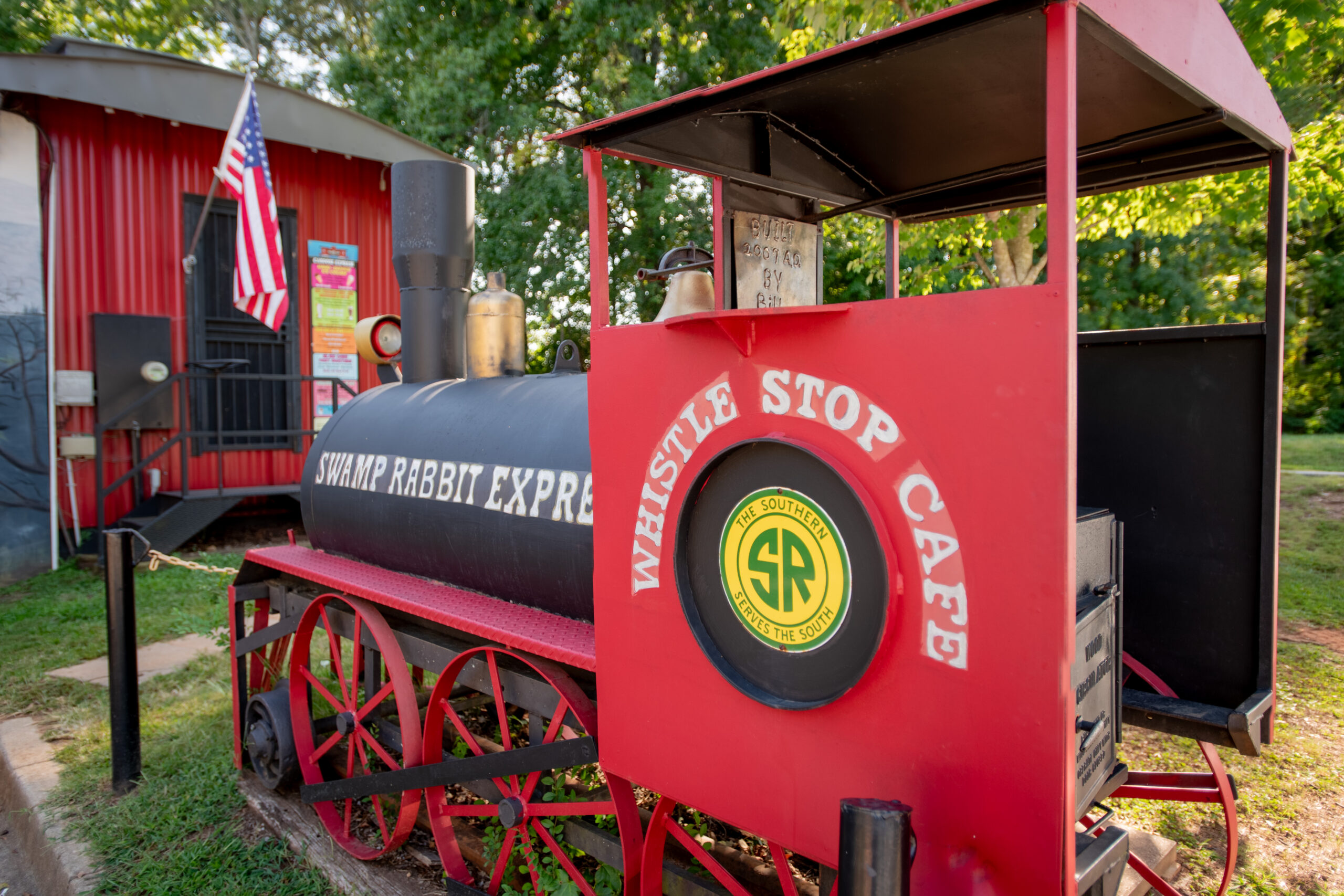
Whistle Stop Cafe offers American home cooking.
The Community Tap has trail access, beer and wine, nonalcoholic drinks and a selection of snacks. It is an option for a break rather than a full restaurant meal.
Farther South in Greenville
Swamp Rabbit Café & Grocery belongs on the list for a longer outing. Located beside the trail at 205 Cedar Lane Road in Greenville, it combines a café, bakery and grocery store with a focus on locally sourced food.
It is not a downtown Travelers Rest stop. Map the full ride there and back before making it your destination.
For additional meal options, see our Restaurants in Travelers Rest, SC: Where Locals Eat guide.
The Road Crossings Worth Knowing
The trail includes street crossings, even though much of the route follows a separate paved corridor.
In downtown Travelers Rest, pay particular attention to Main Street at Center Street/McElhaney Road, near Tandem and Sunrift. This is where the trail changes sides of Main Street. A diagonal crossing project was undertaken at this intersection, so follow the signals and markings in place when you arrive.
Motorists may stop to let trail users cross, but wait until vehicles have stopped and follow the applicable crossing signal before proceeding.
Farther south toward Furman and Greenville, use the official map to identify additional crossings before your ride. Explain stopping and regrouping points to children or less-experienced riders before reaching an intersection.
Trail Etiquette Basics
Greenville County asks trail users to:
- Stop at road crossings.
- Stay right.
- Announce passes with “on your left” or a bell.
- Keep speeds below 20 mph and slow down around other people.
- Keep one ear free to hear approaching users.
- Keep dogs on a short leash and clean up after them.
- Carry out trash.
The downtown stretch serves walkers, runners, cyclists and people entering from nearby businesses. Leave room for others and adjust your pace to the activity around you.
Restrooms and Break Planning
Use the official interactive map to locate restrooms and parking along your chosen route.
Plan around public facilities rather than assuming a business restroom will be available. Bring water, especially for a longer ride, and keep enough time in your schedule for stops.
If you are renting, ask the shop what equipment is included and whom to contact if you have a mechanical problem.
Trail Closures and Updates
Check Greenville County’s trail page before your outing.
You can also text “swamprabbit” to 24639 to receive trail updates, including closures, detours, races and special events.
A familiar route can be affected by maintenance or an event, so check again before a longer ride or a trip built around a particular destination.
Neighborhoods Near the Trail
Velo Living on the Trail is one specific community to know. Its developer describes private resident access to the Swamp Rabbit Trail and locates the community near Watson Road and Old Buncombe Road. That connection is a resident amenity, not a public trail entrance.
Village West, a rental community on West Road, also markets its proximity to downtown and the trail. Proximity should be distinguished from a dedicated trail connection.
Homes around downtown offer other possibilities, but access varies by street and property. Useful details include the nearest public entrance, whether the route includes sidewalks and which crossings separate the home from the trail.
For buyers, those details are more informative than a general “near the Swamp Rabbit Trail” description.
Explore Travelers Rest With Wendy Turner
Considering a home near the Swamp Rabbit Trail? Wendy Turner and the Turneround Homes Team at Real Broker, LLC can help you compare available properties, neighborhood connections and access to downtown Travelers Rest.
Connect with the team to explore homes that fit the way you want to use the trail and spend your time here.
Visit the Travelers Rest Business Directory HERE.
By Wendy Turner and the Turneround Homes Team | Real Broker, LLC